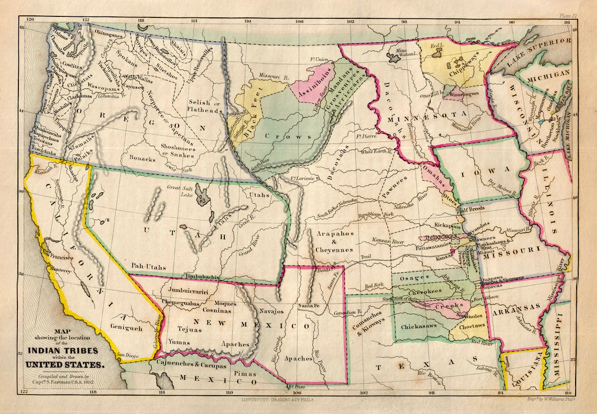
(U.S. West) Map showing the location of the Indian Tribes within the United States. Eastman, 1853 There's a juxtaposition on this map that is interesting. In the vast western territories we see tribal names denoting the general lands of each group, some organically bounded by rivers or mountains, many with no natural borders at all. But in contrast we see tight geometric land tracts running along the western borders of Missouri and Arkansas that were used to pack peoples into a small, foreign ecosystems. Whether intentional or pragmatic this would be a force to break cultures that for generations upon generations had learned to adjust to survival in a larger landscape. Without the lands, a life of interdependence would rapidly become dependent and upended. Here Eastman just looks at the borders of the states and territories, and the situation of native peoples, rivers and major mountains. Condition is very good. Image size is approximately 8 x 11.25 (inches)